Ascension Day Hiking Trails: Combining Faith and Fitness in the Pyrenees
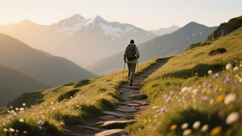
The Pyrenees mountain range, stretching 430 kilometers between the Atlantic Ocean and the Mediterranean Sea along the border between France and Spain, offers some of Europe's most rewarding hiking terrain. Mid-May ? coinciding with the Ascension Day long weekend ? sits at the beginning of the hiking season in the Pyrenees, a window when lower-elevation trails are clear of snow, wildflowers are emerging, and the high passes still carry winter snow that makes for dramatic scenery. This guide covers four distinct hiking options accessible during this period, ranging from gentle walks suitable for beginners to multi-day circuits requiring experience and preparation.
The GR10: France's Trans-Pyrenean Long-Distance Trail
The GR10 (Grande Randonn’e 10) runs 880 kilometers from Hendaye on the Atlantic coast to Banyuls-sur-Mer on the Mediterranean, traversing the French side of the Pyrenees from west to east. The trail was established in 1967 and is maintained by the French Hiking Federation (F’d’ration Fran’aise de la Randonn’e P’destre). The complete trail typically takes 45-55 days to hike, but individual sections can be tackled as day hikes or weekend trips.
Recommended Sections for Mid-May
The western section, between Lescun (in the B’arn) and Etsaut (in the Aspe Valley), is one of the most accessible portions of the GR10 during mid-May. This 25-kilometer segment gains approximately 800 meters in elevation and passes through the Lescun cirque ? a dramatic limestone amphitheater surrounded by peaks rising to 2,500 meters. The trail surface is well-marked with white-red paint blazes, and the terrain is moderate, suitable for hikers with basic fitness and prior day-hiking experience.
Starting from Lescun village (accessible by road from Oloron-Sainte-Marie, approximately 80 kilometers ? 1 hour 30 minutes by car), the trail follows the valley floor for the first 4 kilometers before ascending through beech forest to the Cabane d'Arr’moulit, a mountain hut at 1,750 meters elevation. The hut offers 30 beds and operates from mid-May through October. Reservations are essential during the Ascension weekend ? book at least two weeks in advance by calling +33 5 59 34 42 05. The overnight rate is 38 euros including dinner and breakfast, or 18 euros for a bed without meals.
The second day continues from the Cabane d'Arr’moulit to Etsaut, covering approximately 21 kilometers with a net descent of 900 meters. The trail passes the Lac d'Arr’moulit (a small alpine lake at 1,900 meters) before descending through the Vall’e d'Aspe to the village of Etsaut, where the train station on the Pau-Canfranc line provides transport back to your starting point.
Weather and Conditions in Mid-May
During the second week of May, daytime temperatures on the GR10's western section at elevations between 400 and 1,200 meters average 12-18 degrees Celsius. Nighttime temperatures at the mountain huts (1,500-1,900 meters) average 3-7 degrees Celsius. Snow may persist above 2,000 meters, particularly on north-facing slopes ? hikers should carry microspikes as a precaution. Rainfall probability in the western Pyrenees during May is approximately 40% per day, with showers typically lasting 1-3 hours. A waterproof jacket and trousers are essential regardless of the forecast.
The Camino de Santiago: Crossing the Pyrenees at Roncevaux
The Camino Franc’s ? the most popular route of the Camino de Santiago pilgrimage ? begins at Saint-Jean-Pied-de-Port in the French Basque Country and crosses the Pyrenees via the Col de Lepoeder (1,430 meters) and the Roncevaux Pass (1,057 meters) into Spain. This crossing, which covers approximately 25 kilometers and gains 1,200 meters in elevation on the first day, is one of the most iconic hiking experiences in Europe and is fully accessible by mid-May.
The Route in Detail
From Saint-Jean-Pied-de-Port (elevation 168 meters), the trail climbs steadily through the Nive valley, passing the hamlet of Orisson (at 827 meters) before reaching the Col de Lepoeder at 1,430 meters. The ascent covers approximately 12 kilometers and gains 1,260 meters ? a demanding but straightforward climb on a well-maintained path. From the col, the trail descends through forest to the Collegiate Church of Roncevaux (Colegiata de Roncesvalles) at 1,057 meters, where pilgrims have been received since the 12th century.
The total walking time for this stage is approximately 6-7 hours for a fit hiker, 8-9 hours for a moderate pace. The albergue (pilgrim hostel) at Roncevaux, operated by the Collegiate Church, offers 186 beds at 10 euros per person including breakfast. Reservations are not accepted ? beds are allocated on a first-come, first-served basis. During the Ascension weekend, the albergue typically fills by 3:00 PM, so an early start (before 7:00 AM) from Saint-Jean-Pied-de-Port is recommended.
The alternative route ? the Valcarlos path, which follows the road at lower elevation through the village of Valcarlos ? is 27 kilometers long and gains less elevation (approximately 900 meters). This route is recommended when snow or fog makes the higher Col de Lepoeder route unsafe. In mid-May, the higher route is usually clear, but conditions should be checked at the pilgrim office in Saint-Jean-Pied-de-Port (open daily from 8:00 AM to 7:00 PM from April through October) before departure.
Historical Significance
The Roncevaux Pass has been a crossing point for pilgrims, traders, and armies for over a thousand years. The Battle of Roncevaux in 778 AD ? in which Charlemagne's rearguard, commanded by Roland, was ambushed by Basque forces ? gave rise to the Chanson de Roland, one of the oldest surviving works of French literature. The pass also features prominently in the Codex Calixtinus, the 12th-century guidebook for pilgrims to Santiago de Compostela, which describes the crossing as "a fearful mountain where many pilgrims have perished."
Today, the Collegiate Church at Roncevaux houses a Gothic statue of the Virgin Mary (the Virgen del Zapico) dating to the 14th century, and the church's refectory ? a 13th-century hall with vaulted stone ceilings ? serves as a dining room for pilgrims. The complex is open to visitors from 9:30 AM to 1:00 PM and 3:00 PM to 6:30 PM daily in May, with admission of 5 euros for the church and museum.
Carros de Foc: Spain's High-Mountain Circuit
The Carros de Foc (Chariots of Fire) circuit is an 8-10 day trek through Spain's Aig’estortes i Estany de Sant Maurici National Park in the Catalan Pyrenees. The route connects nine mountain refugios (huts) arranged in a rough circle, with each day's stage covering 4-7 hours of walking at elevations between 1,800 and 2,700 meters. The circuit's total distance is approximately 55-65 kilometers, depending on the exact route taken.
Accessibility in Mid-May
The Carros de Foc circuit presents a challenge for mid-May hikers: at elevations above 2,000 meters, snow cover may still be significant in the second week of May. The park's visitor center at Espot (accessible by road from Lleida, approximately 130 kilometers ? 2 hours by car) provides daily snow condition reports during the spring season, and the recommended approach is to start the circuit on the southern side (lower elevation) and work northward as conditions allow.
The refuge at Refugi d'Amitges (2,380 meters) ? one of the highest and most spectacular on the circuit, perched beside two alpine lakes with views of the Encantats peaks ? typically opens for the season in late May. In 2026, the opening date is projected to be around May 23rd, which would make it inaccessible during the Ascension weekend (May 14-17). Hikers planning a May Carros de Foc trek should focus on the lower-elevation refugios: Refugi de la Mainera (1,865 meters), Refugi de Colomina (2,420 meters ? may be snowbound), and Refugi de Saboredo (2,360 meters).
Refugio reservations for the Carros de Foc are made through the Parc Nacional d'Aig’estortes booking system, and the cost per night is approximately 35-42 euros including half board (dinner and breakfast). The refugios accept credit card payment at the time of booking. For mid-May hiking, a backup plan should be in place in case one or more refugios are inaccessible due to snow ? the descent routes to the valley floor (Espot or Bo’) are always available and take 3-5 hours from any point on the circuit.
Easier Walks Around Lourdes
For hikers who prefer gentle terrain with cultural and spiritual significance, the area around Lourdes in the Hautes-Pyr’n’es offers a network of well-marked trails ranging from 3 to 12 kilometers, with elevation gains of 100-400 meters. Lourdes itself ? one of the most visited pilgrimage sites in the Catholic world, receiving approximately 4 million visitors annually ? sits at 400 meters elevation at the foot of the Pyrenean foothills.
The Chemin des Coteaux
This 8-kilometer circular trail starts from the Sanctuary of Our Lady of Lourdes (the basilica complex on the banks of the Gave de Pau) and climbs through the hillside villages of Batsurgu’re and Juncalas before returning to the town center. The trail gains approximately 250 meters and takes 2.5-3 hours at a moderate pace. Waymarked with yellow paint blazes, the route passes through mixed forest of oak, beech, and chestnut, with views of the Lourdes basilica and the Pyr’n’es mountains beyond.
The trail is suitable for children aged 8 and above and requires no special equipment beyond walking shoes. In mid-May, wildflowers including wild orchids (particularly the early spider orchid and the bee orchid) are in bloom along the forest margins. The trail crosses the Gave de Pau river twice on stone bridges ? the second crossing, at Juncalas, passes a 12th-century Romanesque church that is open for quiet visits from 9:00 AM to 5:00 PM daily.
The Pic du Jer Funicular Walk
The Pic du Jer, a 1,000-meter peak overlooking Lourdes, is accessible by funicular railway (operating daily from 9:30 AM to 5:30 PM in May, with departures every 30 minutes). A round-trip funicular ticket costs 14.50 euros for adults and 7.50 euros for children aged 4-12. At the summit, the "Grande Croix" ? a 23-meter-high illuminated cross erected in 1903 ? offers a panoramic view of the Pyrenees chain stretching from the Atlantic to the Mediterranean on clear days.
From the summit station, a marked trail of approximately 3 kilometers leads eastward along the ridge to the Col de Tr’s-Crouts (1,080 meters), passing through alpine meadows with views of the Gave de Pau valley. The return walk to the funicular station takes approximately 1 hour 30 minutes. The trail is exposed to wind, so a windproof layer is advisable even on warm days.
Combining Pilgrimage and Hiking
For pilgrims visiting Lourdes, the combination of religious observance and hiking is natural. The Sanctuary's morning mass begins at 8:00 AM daily, and the afternoon Rosary procession starts at 3:00 PM (4:00 PM from May through September). Many pilgrims incorporate a morning hike into their visit, returning to the Sanctuary for the afternoon service. The Chemin des Coteaux is ideally suited to this pattern: a morning departure from the Sanctuary at 9:00 AM allows completion by noon, with time for lunch before the afternoon Rosary.
Practical Information for May Hiking in the Pyrenees
Gear Requirements
The essential gear list for mid-May hiking in the Pyrenees includes:
- Waterproof jacket and trousers: Rain is frequent and can arrive quickly. A jacket with a minimum waterproof rating of 10,000 mm is recommended.
- Layered clothing system: Temperature swings of 10-15 degrees Celsius between morning and afternoon are common. A base layer (merino wool or synthetic), a mid-layer (fleece or light down), and a waterproof outer layer provide adequate coverage.
- Sturdy hiking boots: Ankle-supporting boots with Vibram or equivalent soles are essential for the rocky and uneven terrain of the GR10 and Camino routes. Trail runners may be adequate for the Lourdes area walks.
- Microspikes: Lightweight crampons that fit over hiking boots, recommended for sections above 2,000 meters where snow may persist. Priced at 40-70 euros, they add approximately 350 grams per pair to your pack.
- Sleeping bag liner: Mountain huts provide blankets, but a silk or cotton liner (approximately 150 grams, 25-40 euros) adds warmth and hygiene. The liner is particularly useful in May when hut heating may not be fully operational.
- Headlamp: Essential for early starts on the Camino de Santiago stage and for navigating hut corridors at night. A minimum output of 150 lumens is adequate.
Transportation to Trailheads
| Trailhead | From Toulouse | From Barcelona | Public Transport Option |
|---|---|---|---|
| Lescun (GR10 western section) | 2h 30min (180 km) | 4h 00min (300 km) | Train to Oloron-Sainte-Marie + bus (limited May schedule) |
| Saint-Jean-Pied-de-Port (Camino crossing) | 3h 00min (220 km) | 4h 30min (340 km) | SNCF train from Bayonne (1h 15min, 4 trains daily) |
| Espot (Carros de Foc) | 4h 30min (330 km) | 3h 00min (210 km) | Bus from Lleida (2h, 2 services daily) |
| Lourdes (hillside walks) | 2h 00min (150 km) | 4h 00min (310 km) | SNCF train from Toulouse (2h 15min, 6 trains daily) |
Booking Mountain Huts and Refugios
Advance booking for mountain huts in the Pyrenees is essential during any holiday weekend. The GR10 huts operated by the F’d’ration Fran’aise de la Randonn’e P’destre can be booked online at refuges-ffrp.fr or by telephone. The Spanish refugios in the Aig’estortes park are booked through the Parc Nacional d'Aig’estortes website (aiguestortes.cat). The Roncevaux albergue does not accept reservations.
For the Ascension weekend specifically, huts within 1-2 days' walk of major trailheads typically fill 3-4 weeks in advance. More remote huts (those requiring 3+ days of hiking to reach) may still have availability 1-2 weeks ahead. If your preferred hut is full, the descent routes to valley villages always provide an alternative ? though these villages may also be busy during the long weekend.
"The Pyrenees in May are a hiker's secret. The snow line creates a natural boundary between the green valleys below and the white peaks above, and every day you spend on the trail is a negotiation between these two worlds. You start in the forest and finish above the clouds. That transition ? from the familiar to the extraordinary ? is what makes the Pyrenees different from every other mountain range I've walked." ? Elena Mart’nez, guide and author of Walking the Pyrenees: A Seasonal Guide (2024), speaking at the International Mountain Walking Conference in Jaca.
Respecting the Mountains and Their Communities
The Pyrenees are not a wilderness in the sense of an uninhabited landscape. The valleys and villages along the GR10, the Camino route, and the Carros de Foc circuit are home to communities that have lived in these mountains for centuries. Hikers should be aware of the following:
- Respect agricultural land: Many trails pass through grazing pastures used by sheep and cattle in the summer. Keep dogs on leads, close gates behind you, and avoid trampling crops. The transhumance (seasonal movement of livestock to high pastures) typically begins in late May or early June.
- Support local economies: Buying bread, cheese, and wine from village bakeries and farm shops, and staying in local g’tes and refugios rather than camping wild (which is restricted in most areas of the Pyrenees), helps sustain mountain communities.
- Carry out all waste: The "leave no trace" principle applies everywhere in the Pyrenees. Mountain huts provide waste disposal facilities ? use them. Do not leave food scraps or packaging on trails.
- Check fire restrictions: May marks the beginning of the fire risk season in the southern Pyrenees. Campfires are prohibited in most areas of Aig’estortes National Park and in many parts of the French Pyrenees from June through September. In May, restrictions may already apply during dry periods ? check with local authorities before lighting any fire.
The combination of Ascension Day's long weekend and the Pyrenees' hiking terrain offers an opportunity that is both physically rewarding and culturally enriching. Whether you are walking the Camino de Santiago with centuries of pilgrim history beneath your feet, traversing the GR10 through wildflower-filled valleys, or taking a gentle walk around Lourdes with the mountains rising behind the basilica, the experience connects you to a landscape that has shaped ? and been shaped by ? human presence for thousands of years.